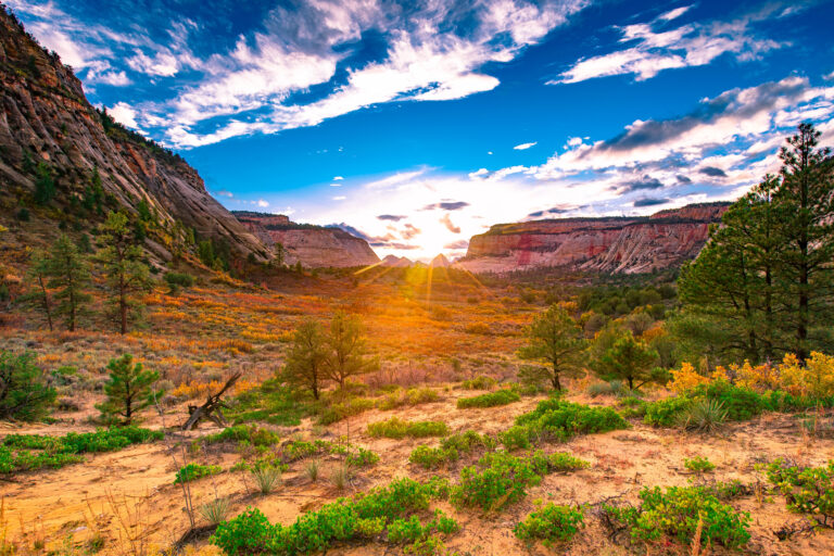


Asheville is one of the best basecamps for national parks in the eastern United States, and I do not say that lightly. From downtown you can be inside the most-visited national park in the country in about an hour, and you can pick up the most-visited unit of the entire park system at the edge of town without driving anywhere at all. The Great Smokies is the rare park that lives up to the hype.
Here is the honest math, and there is a hard truth in it. Hurricane Helene tore through western North Carolina in September 2024 and hit Asheville and long stretches of the Blue Ridge Parkway hard. As of 2026 the recovery is real but unfinished. The Parkway has reopened in stages and most of it is drivable again, though some sections near Asheville still carry closures and active repair work. The Great Smokies came through in much better shape and are fully open. So this is not the pristine, nothing-to-see-here version some roundups will sell you. It is the real one, with current conditions flagged where they matter.
I have ordered these by what I think of as drive-cost versus payoff. The closest and best come first, the long hauls last. The two coastal seashores are six to eight hours out, which makes them a separate vacation rather than a trip from Asheville, and I have been straight about that. Before you go anywhere, check nps.gov for current Parkway closures and remember that the Smokies now charge for parking even though entry is still free. More on both below. If you only have one weekend, skip to the planning section at the bottom and I will tell you where to point the car.

Asheville’s Parks At A Glance
Drive times are from downtown Asheville. Fees listed are 2026 rates. Note that the Great Smokies remains free to enter but now requires a paid parking tag, which I have spelled out below. The two national seashores at the bottom are genuine long hauls, six to eight hours one way.
117 public lands destinations are under threat. Get the free briefing that 27,000+ people use to stay informed and take action.
| Park | Drive from Asheville | Best season | Signature draw | Entrance fee (2026) |
|---|---|---|---|---|
| Great Smoky Mountains NP | ~1 hr to nearest entrance | Late Apr to Jun, Oct | Misty ridgelines, Cades Cove, waterfalls | Free entry, parking tag required ($5/day, $15/week, $40/year) |
| Blue Ridge Parkway | Runs through Asheville (0 min) | Oct for foliage, May to Jun | Mountain overlooks, the great American scenic drive | Free (check NPS for Helene closures) |
| Appalachian National Scenic Trail | ~45 min to 2 hr to access points | May to Oct | Day hikes on the Roan Highlands and Max Patch | Free |
| Carl Sandburg Home NHS | ~40 min (Flat Rock) | Spring and fall | The poet’s farmhouse and goat herd | ~$5/person for the house tour; grounds free |
| Congaree NP | ~3 hr (South Carolina) | Oct to Apr | Old-growth bottomland forest, boardwalk loop | Free |
| Cape Hatteras National Seashore | ~7 hr 30 min (far) | May to Sep | 70 miles of beach, the black-and-white lighthouse | Free |
| Cape Lookout National Seashore | ~8 hr (far) | May to Sep | Wild horses, the diamond lighthouse, ferry-only | Free (ferry fare extra) |
1. Great Smoky Mountains National Park
Drive time from Asheville: about 1 hour to the nearest entrance. Five park entrances sit within roughly 70 miles of downtown, with the Oconaluftee entrance near Cherokee being the closest from the North Carolina side.
Entrance fee: none. The park is still free to enter, the only one of the country’s big-name parks that is. The catch is the Park It Forward parking tag, in effect since 2023. If you park anywhere in the park for more than fifteen minutes you need one, and it runs $5 per day, $15 per week, or $40 for the year. Buy it ahead at recreation.gov or grab it at a visitor center.
This is the one I send everybody to first, and it is the closest real wilderness to Asheville by a wide margin. Great Smoky Mountains National Park straddles the Tennessee and North Carolina line, and at over 500,000 acres it protects the largest stretch of old-growth forest in the eastern US along with more salamander species than anywhere else on the planet. President Franklin Roosevelt dedicated it in 1940, the first national park created in the East, and unlike the western parks built on federal land, this one was stitched together from privately owned farms and timber tracts that families had to be bought out of. You can still feel that history in the old homesteads scattered through the coves.

What to actually do here. Drive Newfound Gap Road across the spine of the mountains, the only road that crosses the whole park, and stop at Clingmans Dome, the highest point in the park at 6,643 feet, where a short paved climb to the observation tower gives you the long view over the ridges that named the place. Get to Cades Cove early for an eleven-mile loop drive through an open valley where black bears, white-tailed deer, and wild turkey graze the meadows against a backdrop of restored 1800s cabins and churches. For waterfalls, the Abrams Falls trail off Cades Cove is five miles round trip to a wide, powerful drop, and Laurel Falls is an easy paved 2.6-mile walk that works for almost anyone. Stay for the haze that gives the mountains their name. It is real, it is natural, and at sunrise from the right overlook it stacks the ridges into blue paper cutouts.

Honest caveats. This is the most-visited national park in the country, with more than twelve million visitors a year, so timing is everything. The crowding is concentrated, not constant. Cades Cove on a fall Saturday becomes a parking lot on wheels, the eleven-mile loop crawling bumper to bumper for hours. The fix is the vehicle-free mornings, when the loop road closes to cars on select days so you can bike or walk it in quiet. Check the current schedule before you go. October foliage and the synchronous firefly event in late spring are the two peak windows, and both require planning. Spread out beyond the famous spots and the park empties fast, because the vast majority of visitors never leave their cars. And do not forget the parking tag. Rangers do check.

Watch Our Great Smoky Mountains Film

2. Blue Ridge Parkway
Drive time from Asheville: none. The Parkway runs straight through the edge of town, and you can be on it in ten minutes from downtown.
Entrance fee: free. There is no gate and no fee anywhere along its 469 miles. Check nps.gov for current Helene closures before you set out, because some sections near Asheville are still under repair.
The Blue Ridge Parkway is the single most-visited unit in the entire National Park System, and Asheville sits right in the middle of it. The Parkway runs 469 miles along the crest of the Blue Ridge from Shenandoah in Virginia down to the edge of the Great Smokies, and it was built as a Depression-era public works project starting in 1935, designed to be driven slowly. There are no billboards, no trucks, and no straight lines, just overlook after overlook. The stretch around Asheville includes some of the highest and most dramatic miles of the whole road, climbing past 6,000 feet near Mount Mitchell, the highest peak east of the Mississippi.

What to actually do here. Drive it, obviously, but drive it with stops. South of Asheville, the run toward Graveyard Fields and Devils Courthouse delivers waterfalls, high-elevation spruce forest, and short trails right off the road. North of town, the climb to Craggy Gardens explodes with purple rhododendron in mid-June, and the spur road up Mount Mitchell takes you to the literal top of the eastern US at 6,684 feet. The Folk Art Center just east of Asheville is a worthwhile free stop, and the overlooks are the whole point. You will pull over more than you drive. The light is best in the first hour after sunrise and the last hour before sunset, when the ridges separate into layers and the haze glows.
Honest caveats. This is where the Helene recovery matters most. Hurricane Helene in September 2024 washed out and buried long sections of the Parkway in western North Carolina, and the repair bill ran past a billion dollars. As of 2026 the long stretch from Asheville south to Cherokee, more than 80 continuous miles past Mount Pisgah and Graveyard Fields, is open and drivable, which covers most of what you would want from town. The piece still under repair sits north of Asheville, roughly between Linville Gorge and Mount Mitchell, with crews aiming to have it fully back by the end of the year. Treat that northern stretch as possibly closed and confirm any section on nps.gov before you commit. Beyond Helene, parts of the high country close in winter for snow and ice with no warning, and fog can drop visibility to nothing in minutes at elevation, so slow down. October foliage weekends bring heavy traffic to the overlooks. Pick your weekend with our North Carolina fall foliage map. Go on a weekday if you can.
3. Appalachian National Scenic Trail
Drive time from Asheville: about 45 minutes to 2 hours, depending on which access point you choose. The trail crosses the mountains all around Asheville.
Entrance fee: free. The trail itself costs nothing to hike. Some trailheads charge for parking, and one of the best day hikes near Asheville runs through Great Smoky Mountains park land where the parking tag applies.
The Appalachian Trail runs more than 2,190 miles from Springer Mountain in Georgia to Mount Katahdin in Maine, and it threads right through the mountains around Asheville. Congress designated it a National Scenic Trail in 1968, and the National Park Service administers it as a unit of the system even though most people experience it as a footpath rather than a park. You do not need to thru-hike to get the payoff. The day hikes near Asheville are some of the best on the entire trail.

What to actually do here. Head for the grassy balds, the open mountaintop meadows that make this stretch of the AT unlike anywhere else. The Roan Highlands, about two hours northeast of Asheville on the Tennessee line, string together Round Bald, Jane Bald, and Grassy Ridge in a few miles of open ridge walking with 360-degree views and a famous rhododendron bloom in mid-June. Closer in, Max Patch is a short, steep climb to a mowed summit bald about an hour northwest of town, popular enough that it now has permit and camping restrictions to protect the meadow. Both are day hikes, both deliver the kind of view people drive across the country for, and both are free.

Honest caveats. The balds are exposed, so weather turns fast and there is no shelter from sun, wind, or lightning once you are up top. Check the forecast and turn around if storms build. Max Patch has been loved nearly to death, so follow the current rules, pack out everything, and do not camp on the summit. Black bears are active across the whole region, so store food properly. Spring brings mud and stream crossings, and the rhododendron window in June is short and crowded. Go early in the day for parking and quiet.
4. Carl Sandburg Home National Historic Site
Drive time from Asheville: about 40 minutes (roughly 31 miles via I-26 east to Flat Rock).
Entrance fee: the grounds and trails are free. The guided tour of the house runs about $5 per adult, with discounts for kids and seniors. Check current rates and tour times on nps.gov.
This is the easy half-day trip, and it is a good change of pace from the high country. Carl Sandburg Home National Historic Site preserves Connemara, the Flat Rock farm where the Pulitzer Prize-winning poet and Lincoln biographer spent the last 22 years of his life. Sandburg was one of the defining American writers of the twentieth century, and the house sits almost exactly as he left it in 1967, with roughly 12,000 of his books still on the shelves. His wife Lilian raised a champion herd of dairy goats here, and their descendants still graze the property, which is a bigger hit with kids than you would expect.
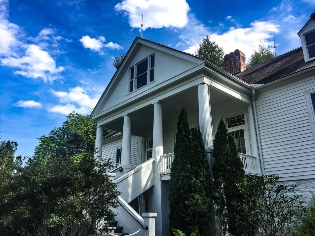
What to actually do here. Take the ranger-led tour of the house to see the writing study and the books, then walk the grounds, which are open free of charge. Five miles of trails climb to the top of Big Glassy Mountain for a view back over the property, an easy walk that turns the visit into a half day outdoors. Stop by the goat barn, especially in spring when the kids are born. The whole site works as a relaxed morning or afternoon, and it pairs well with a meal in nearby Hendersonville on the way back.
Honest caveats. The house can only be seen on a guided tour, and tours have limited capacity and set times, so check the schedule and arrive early on busy weekends. The walk up to the house from the parking area is a moderate uphill, and the Big Glassy trail is steeper than it looks, so wear real shoes. This is a quiet, low-key site, so set expectations accordingly. It is history and a pleasant walk, not a wilderness adventure.
5. Congaree National Park
Drive time from Asheville: about 3 hours (roughly 175 miles south into central South Carolina, near Columbia).
Entrance fee: free. There is no entrance fee at Congaree.
Cross the state line into South Carolina and you reach the only other full national park within reasonable reach of Asheville. Congaree protects the largest stretch of old-growth bottomland hardwood forest left in the country, a floodplain along the Congaree River where some of the tallest trees in the eastern US grow, including loblolly pines well over 150 feet. It became a national park in 2003 after decades as a national monument, saved by a grassroots fight in the 1970s when the old growth was about to be logged. This is a swamp forest, flat and green and quiet, the opposite of the mountains in every way, which is exactly why it is worth the drive.
What to actually do here. Walk the Boardwalk Loop, a 2.4-mile raised boardwalk that carries you through the heart of the old-growth forest without getting your feet wet, the single best introduction to the park. Rent or bring a kayak and paddle Cedar Creek, a marked water trail that winds under the giant trees and is the real way to see the place. If you can time a visit for late May or early June, the synchronous fireflies put on one of only a handful of such displays in North America, and it draws a lottery-controlled crowd. The rest of the year you will often have the boardwalk nearly to yourself.
Honest caveats. The name on the park was once Congaree Swamp, and it earns it. Mosquitoes here are aggressive enough that the visitor center keeps a sign with a meter rating the daily misery, so bring repellent from late spring through fall. The park floods regularly, which is the whole point ecologically, but it means the boardwalk or trails can be underwater after heavy rain, so check conditions first. Go October through April for the best weather and the fewest bugs. Summer is hot, humid, and buggy.
6. Cape Hatteras National Seashore
Drive time from Asheville: about 7 hours 30 minutes (roughly 490 miles east via I-40 and US-64). This is a long haul, plan it as a destination, not a day trip.
Entrance fee: free. There is no entrance fee, though some beach access and the lighthouse climb carry small charges.
I will be honest about this one. Cape Hatteras is most of the way across the state, and from Asheville it is a full day in the car. But if you are already heading to the Outer Banks, it is the best of the East Coast’s wild beaches. The seashore protects more than 70 miles of barrier-island beach along the Outer Banks, the first national seashore in the country, authorized in 1937. The famous black-and-white spiral lighthouse at Cape Hatteras is the tallest brick lighthouse in the United States, and it was famously moved 2,900 feet inland in 1999 to save it from the eroding shore.
What to actually do here. Climb the lighthouse if it is open for the season, swim and walk the long open beaches, and chase the shorebirds and shipwrecks that give this coast its nickname, the Graveyard of the Atlantic. The Buxton Woods Trail is a short three-quarter-mile loop through one of the largest maritime forests left on the East Coast. Anglers come for some of the best surf fishing in the country, and the wind makes this a serious kiteboarding and windsurfing destination.

Honest caveats. The drive is the whole problem. At seven and a half hours each way this is not an Asheville day trip, it is a vacation in its own right, so build it around several nights on the coast. Summer is hot and the beach towns book up, while hurricane season from August through October can close roads and wash over the island highway. There is little shade once you are on the sand, so bring water and sun protection. Driving on the beach requires a permit in many areas.
7. Cape Lookout National Seashore
Drive time from Asheville: about 8 hours (roughly 430 miles east via I-40), plus a ferry to reach the islands. The farthest park on this list.
Entrance fee: free, but there is no road to the islands. You pay for a passenger or vehicle ferry, which is the real cost of admission.
This is the farthest and the wildest, and it is genuinely hard to reach, which is exactly why it stays empty. Cape Lookout protects three undeveloped barrier islands south of the Outer Banks, with no bridges, no roads, and no towns, just 56 miles of empty beach reachable only by boat. The diamond-pattern lighthouse and the herd of more than 100 wild horses on Shackleford Banks are the draws. Those horses have roamed the island for centuries, descended from animals that came ashore generations ago, and they are managed as a protected herd now.
What to actually do here. Take the ferry over, walk the beaches, and watch the wild horses on Shackleford Banks from a respectful distance, fifty feet minimum by law. Climb the Cape Lookout Lighthouse when it is open, collect shells, up to two gallons a day are allowed, and fish the surf. The islands are primitive, so the experience is less about activities and more about having miles of Atlantic coast almost entirely to yourself.

Honest caveats. Everything here is harder than at Hatteras. You cannot drive to the islands, so you are tied to ferry schedules and weather, and the ferry adds cost and planning. There is no shade, no stores, and limited drinking water once you are across, so carry everything in and pack everything out. Keep your distance from the wild horses, which are unpredictable and protected by law. Camping is primitive only. And at eight hours from Asheville, this belongs on a dedicated coastal trip, not a quick getaway.
How To Pick, And A Weekend Plan
If you only get one weekend out of Asheville, here is how I would choose.
- Easiest first trip: the Great Smokies. Closest, free to enter, and the highest payoff for the least driving. Leave early, buy your parking tag ahead, drive Newfound Gap Road and loop Cades Cove in the morning before the crowds, and you can do it as a long day trip or an easy overnight in Cherokee or Bryson City.
- Best with zero planning: the Blue Ridge Parkway. It starts at the edge of town, costs nothing, and you can do as much or as little as you want. Just check nps.gov for current Helene closures first, then drive south toward Graveyard Fields or north to Craggy Gardens and Mount Mitchell.
- Best day hike: the Appalachian Trail balds. Drive up to the Roan Highlands or Max Patch, climb to an open summit meadow, and get one of the best views in the East for the price of a tank of gas. Best in June for the rhododendron or October for the color.
- Best change of pace: Congaree. Three hours south puts you in an old-growth swamp forest that feels nothing like the mountains. A flat boardwalk and a kayak creek make it an easy, low-effort overnight from Asheville, best in the cooler months.
- The long coastal haul: Cape Hatteras or Cape Lookout. Seven to eight hours each way means do not pretend it is a weekend from Asheville. Build a full coastal trip of several nights around it and treat the seashore as the main event, not a side trip.
One more honest note on what counts as near. People always ask about Shenandoah and the rest of the Parkway up in Virginia, and yes, you can reach them, but they are several hours north and belong on a different trip. The real answer for Asheville is that you do not need to go far. The two best public lands destinations on this whole list, the Great Smokies and the Blue Ridge Parkway, are the two closest. That is a luxury most cities do not have.

Frequently Asked Questions
Great Smoky Mountains National Park is the closest national park to Asheville, with the nearest of its five entrances about an hour from downtown. Entry is free, but the park now requires a paid parking tag, $5 per day, $15 per week, or $40 per year, for any stop longer than 15 minutes.
Yes, the section that matters most from town is open. As of 2026 the Parkway runs continuously from Asheville south to Cherokee, more than 80 miles past Mount Pisgah and Graveyard Fields. The stretch still under repair from Helene sits north of Asheville between Linville Gorge and Mount Mitchell, expected back by the end of the year. Always check the current closure list on nps.gov before you drive, since conditions change as repair work continues.
There is no entrance fee at Great Smoky Mountains National Park, the only one of the major national parks that is still free to enter. However, the Park It Forward program requires a parking tag for any vehicle parked more than 15 minutes, at $5 per day, $15 per week, or $40 per year.
You should know that this guide does not come out of thin air. More Than Just Parks is a family operation. My sons Will and Jim have spent their adult lives exploring America’s national parks and public lands destinations, working with the National Park Service, the Department of the Interior, the USDA, and the U.S. Forest Service on films about the places that matter. Their work has run in publications around the world, and a few people outside our own family have even called them experts on the parks. I taught American history for 25 years, and I write our history and travel guides.