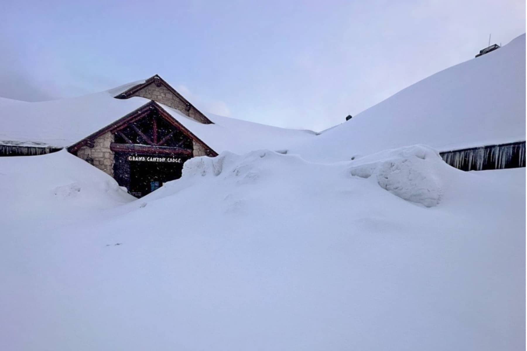
2026 Update: The Grand Canyon Lodge on the North Rim was destroyed by the Dragon Bravo Fire in July 2025. No overnight lodging is available on the North Rim. River Trail and Silver Bridge are closed through June 30, 2026 (Transcanyon Waterline Replacement). Hikers must use South Kaibab Trail via Black Bridge to reach Phantom Ranch. Plateau Point Trail is also closed. Mule rides are cancelled through June 30, 2026.
The Box of North Kabib Trail
Between Cottonwood Campground and Phantom Ranch comes the most dangerous part of the trail if you’re hiking in the heat, The Box. The trail here spans seven miles of claustrophobic canyon walls made of Vishnu Schist. It would be impressive to know it’s 1.7 billion years old, older than any other rock in the park, if that dark-colored wall of heat-absorbing rock didn’t radiate like a furnace.
The trail is pretty even here with a lower elevation, but my goodness, the heat is intense. Avoid this section between 10:00 am and 4:00pm in summer. Time your trip to get to Bright Angel Campground by 10:00 am.
Once you’re hiking outside of the box, you come to Phantom Ranch and Bright Angel Campground before you cross the river and follow your South Rim route.
NOTE: If you are camping at Havasupai Gardens, you’ll need to take the Bright Angel Trail, not South Kaibab Trail.
Rim to Rim Trail Transition to South Rim
Toroweap Point | Grand Canyon Itinerary
The Colorado River lures me like a magnet to metal. Spending time at the inner canyon along the river is one reason I would argue that taking an overnight (or two) backpacking trip is well worth the frustration of a permit system and the patience needed to get a spot.
Before you head on your chosen South Rim ascent, you have this amazing social and wilderness location where strangers become friends. Rafters from the river meet with weary hikers on beaches and rocky shores. I took a moment of solace and gratitude, climbing up a rock to meditate. This river before you tirelessly and persistently carved this grandest of canyons that rise around you.
The fierce nature of the Colorado River strongly discourages hikers from swimming in it.
Rim to Rim Bright Angel Trail
Length:9.5 miles
Elevation at Bright Angel Campground: 2,480 feet
Elevation at Trailhead: 6,860 feet
From the turnoff to Bright Angel Trail on the south side of the river, you’ll walk an easy 1.2 miles to the Pipe Creek Resthouse while you hug the canyon. The river follows until you take the turn south.
The next four miles are known as “The Death Zone” (though you won’t find that in any park publications). It’s another stretch of dark Vishnu rocks tower above you. It’s not quite as boxed in as “The Box,” but just as foreboding. The majority of rescues that happen hiking rim to rim in Grand Canyon National Park happen here. Tackle this stretch before 10:00 am.
The Vishnu Rocks in the Grand Canyon are black because they are made of dark schist rock.
Composition – The metamorphic rock formed under intense heat and pressure, altering its original composition and giving it a dark color. Minerals like biotite mica lend it a very dark gray or black appearance.
Patina – This “desert tarnish” forms gradually as moisture evaporates, leaving behind manganese and iron oxides that stain the rock faces black.
Algae/Lichen – Dark-colored algae or lichens may grow on the rock surfaces, turning them black. The Vishnu Rocks are located in a wetter part of the canyon where algae and lichens are more likely to thrive.
Shadows – As the “basement” of the Grand Canyon, the rocks can also appear darker due to the lack of sunlight.
Enjoy the respite of Garden Creek, less than a mile on the journey. You’ll face more switchbacks ahead.
Havasupai Gardens on Bright Angel Trail
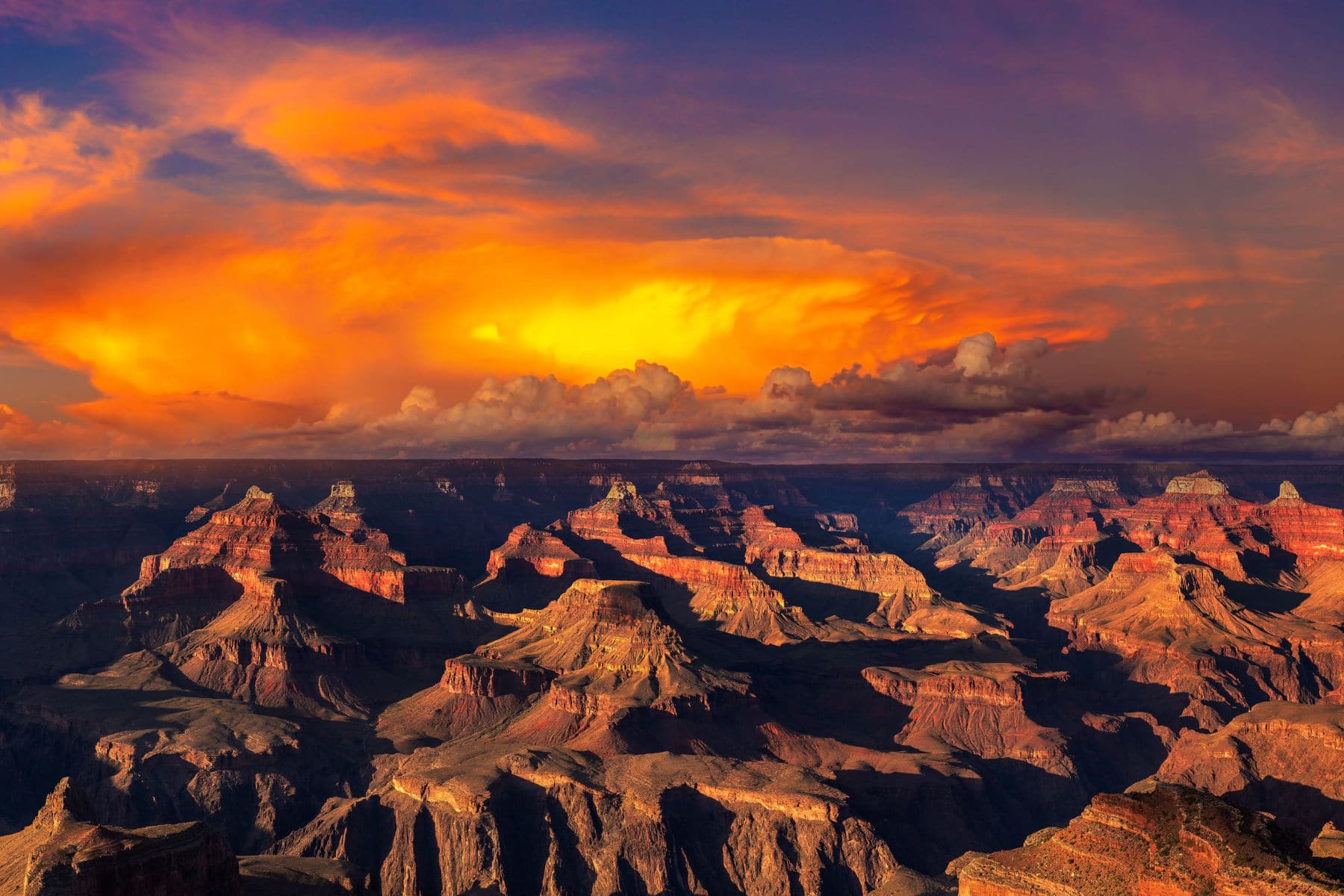
Panorama of Grand Canyon National Park at Powell Point at sunset, Arizona. (Shutterstock-
About halfway through the Bright Angel Trail, you come to Havasupai Gardens. A campsite is here, which requires reservations, but you’ll also find a ranger’s station, restrooms, and seasonally available potable water.
Several trails spur from this region too. I don’t recommend any of them if you’re hiking rim to rim in Grand Canyon as a day hike. A 1.5-mile hike to Plateau Point normally offers another stunning view of the Canyon only available to people willing to take a trek this far into the canyon. However, the Plateau Point Trail is closed through June 30, 2026 due to the Transcanyon Waterline Replacement project.
Bright Angel Trail Final Stretch
Rim to Rim Grand Canyon (NPS/Michael Quinn)
Psych yourself up for switchbacks because Bright Angel Trail climbs a lot of them over the next few miles. The first series of switchbacks goes by the nickname Jacob’s Ladder.
The hikers who prefer the Bright Angel Trail when hiking rim to rim in Grand Canyon National Park likely do because of the resthouses along the way. At the top of Jacob’s Ladder, you’ll find Three Mile-Resthouse. Another series of steep switchbacks take you to the Mile-and-a-Half Resthouse.
These switchbacks can be brutal. You’ll also be dodging mules and one of the busiest trails in the Grand Canyon at the same time. Steep drops and narrow trails provide even more nail-biting experiences.
In August 2026, a 13-year-old was moving out of the way for others to take photos when he fell 100 feet. He survived, but it’s a solemn reminder of how dangerous this trail can be. Don’t risk your life so others can take a selfie.
You’ll go through two short tunnels before reaching the top of Bright Angel Trail, which is right by the Bright Angel Lodge.
Rim to Rim South Kaibab Trail
Length:7 miles
Elevation at Bright Angel Campground: 2,480 feet
Elevation at Trailhead: 7,260 feet
Heading back down the canyon to the Black Bridge, you’ll immediately be on the South Kaibab Trail. No water, ranger stations, or restrooms are available on this seven-mile trail. While there are reports of emergency water supplies along the path, don’t rely on those to be available. If you find one, only use it if you are in a life-threatening situation.
South Kaibab Trail has several milestones along the way:
The Tipoff: (4,000 feet) Nearly two miles through more Visnhu rock-line trails, you’ll weave up from the inner canyon to the Tipoff rest point. The only shelter on the trail is here, so you can find shade or shelter from storms. An emergency phone is available in the shelter. Previous restrooms here have been removed.
Skeleton Point: (5,200 feet) This provides the last view of the Colorado River if you’re heading to the trailhead. The scenic view is well worth a stop, especially since you’ve just finished some gnarly switchbacks.
Cedar Ridge: (6,120 feet) This 360° view will likely be crowded, as it’s the turnaround point suggested for beginning hikers starting from the South Kaibab trailhead.
Ooh Ahh Point: (6,470 feet) You’re now less than a mile from the trailhead, but for those heading down the trail, the first below the rim is available. That’s why it’s called the “Ooh Ahh Point.”
The South Kaibab Trail is pretty straightforward, and you can tell in the design how the goal was to get to the river as fast as possible. I personally feel that the trails here are wider and provide fewer “I’m about to fall to my death” moments than Bright Angel. However, I’m also not the best at heights.
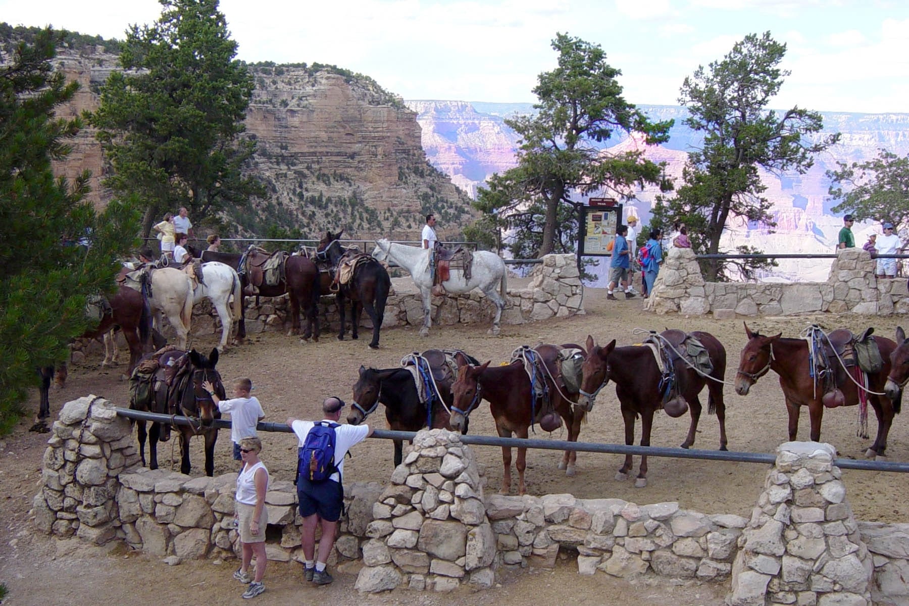
Mules headed down into the Canyon
Is hiking the Rim to Rim Grand Canyon trails the same as R2R2R?
The R2R2R adventure is for elite athletes and ultra runners only. The R2R2R is “Rim to Rim to Rim,” or the “Double Rim to Rim” is going from one to the other and back again. That’s nearly 50 miles with an elevation change that totals the height of Mt. Denali twice.
How hard is hiking from Rim to Rim at the Grand Canyon, really?
My mind immediately went to the scene in Moneyball where Billy Beane talks to Scott Hatteberg about playing first base. He says, “It’s not that hard, Scott. Tell ’em Wash (Ron Washington).” Wash quickly replies, “It’s incredibly hard.”
You need excellent physical fitness, discipline, mental focus, and altitude conditioning, on top of being able to ration water and food through some of the harshest ecosystems on earth. To quote another baseball movie, A League of Their Own, “The hard is what makes it great.”
What if I can’t finish the hike?
More than 250 rescues happen each year in the Grand Canyon. Most rescues are due to accidents or hikers being unprepared for the conditions. If you need to be rescued, the inner canyon rescue costs are paid for by the park service, but any ambulance by road or flight will be at your own expense. It’s another reason to really train for this hike months in advance.
Helpful Related Links
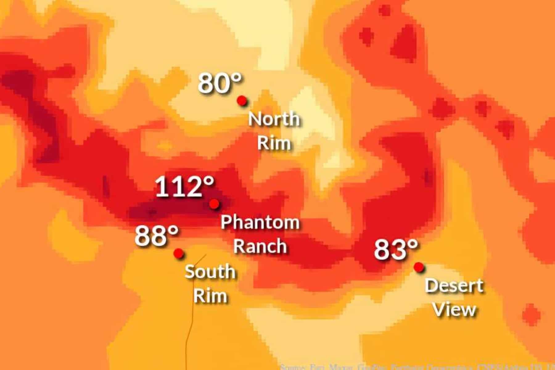
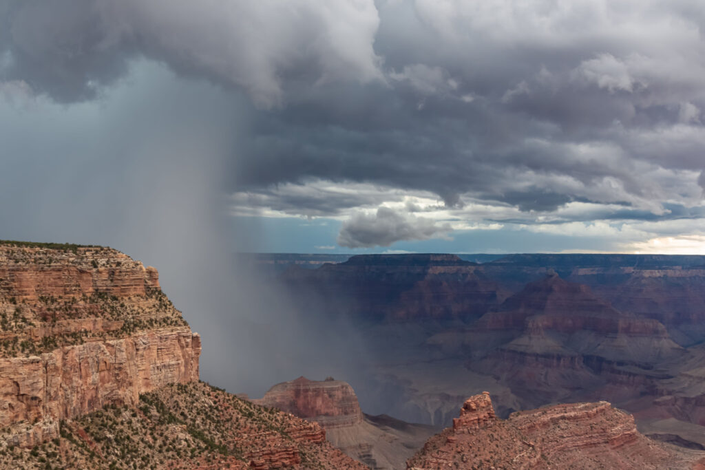
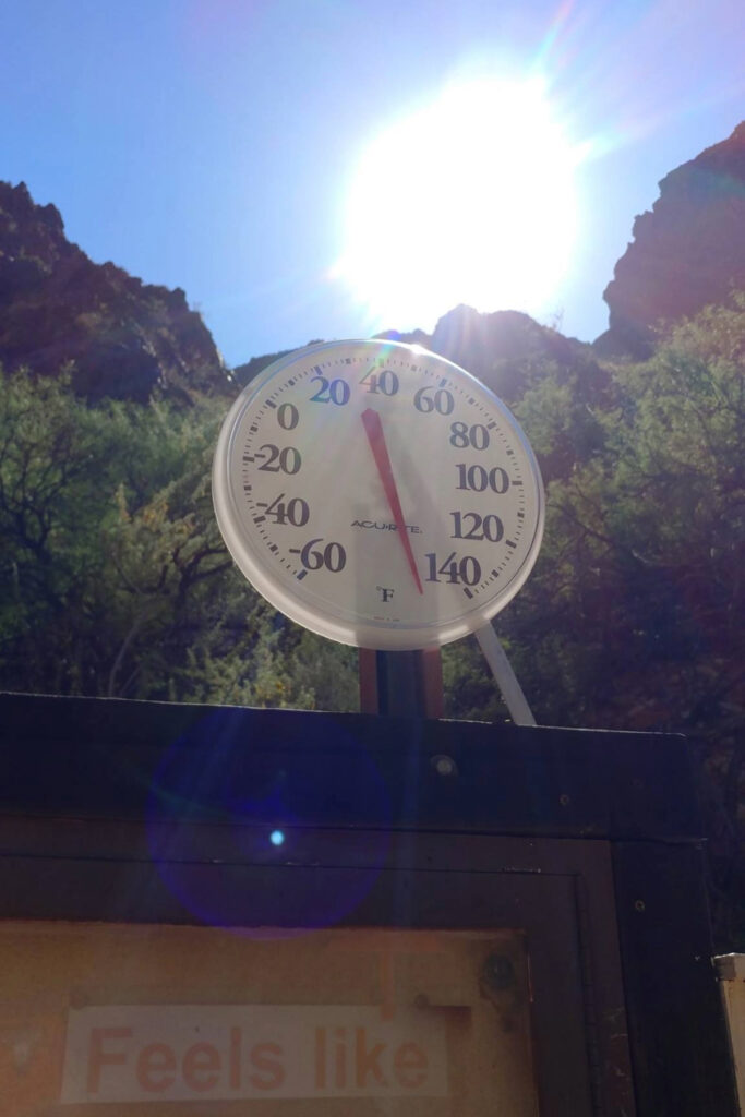
The world-famous Grand Canyon mules stopped after another trip down Bright Angel Trail. (NPS Photo)A monsoon storm rolls in over Point Imperial at the North Rim of the Grand Canyon in August 2022. (NPS Photo/J. Baird)A June photo of the temperature at Phantom Ranch in Grand Canyon National Park (NPS Photo)
So Much More to Explore: 20 EPIC Things to Do in the Grand Canyon
Free Help Planning Your Grand Canyon Trip: Ultimate Grand Canyon Itinerary (Visiting 1 to 3 Days)
Hiking Rim to Rim: Detailed Guide to Hiking Rim to Rim in the Grand Canyon
Go North, You Can Thank Us Later: The North Rim of the Grand Canyon is Better
Two brothers who've spent their entire adult lives exploring America's public lands and fighting to protect them. What started as a film project has grown into one of the most active public lands grassroots networks in the country. 25,000+ people now stand with us.