Wisconsin has four National Park Service sites, and the one worth planning a trip around is Apostle Islands National Lakeshore. The other three are long-distance routes and a shared riverway, which makes the state less of a checklist and more of a region you move through.
I taught American history for 25 years before my brother and I started filming public lands full time. I have a soft spot for places like these, the ones that do not draw crowds but reward the people who show up. Wisconsin is squarely in that camp.
Here is my honest take. If you want the big payoff, go to the Apostle Islands. Sea caves, lighthouses, and 21 islands on Lake Superior. The rest of the roster is for people who like a trail or a paddle and do not need a marquee attraction at the end of it.
A note on the count, because the rosters online are usually wrong. Wisconsin has zero full National Parks, the capital-letter kind like Yellowstone or Acadia. There are only 63 of those. What the state does have is four NPS units of other designations: one national lakeshore, one national scenic riverway, and two national scenic trails. One of those trails, the Ice Age Trail, runs entirely inside Wisconsin and is one of only a handful of national scenic trails contained in a single state. That is a genuine distinction, so I rank it on its own rather than burying it in a trails note.
109 public lands destinations are under threat. Get the free weekly briefing that 25,000+ people use to stay informed and take action.
Wisconsin National Park Sites Compared
| Site | Designation | The Draw | 2026 Fee |
|---|---|---|---|
| Apostle Islands National Lakeshore | National Lakeshore | 21 islands, sea caves, historic lighthouses on Lake Superior | Free |
| Ice Age National Scenic Trail | National Scenic Trail | ~1,200 miles tracing the last glacier’s edge, all in Wisconsin | Free |
| Saint Croix National Scenic Riverway | National Scenic Riverway | 200+ miles of clear river, shared with Minnesota | Free |
| North Country National Scenic Trail | National Scenic Trail | Multi-state route crossing northern Wisconsin | Free |
Fees are easy here. None of Wisconsin’s four NPS sites charges an entrance fee. The America the Beautiful pass, the $80 annual pass that covers the big fee parks out west, buys you nothing extra in Wisconsin because there is nothing to pay for at the gate. You will spend money on a boat tour at the Apostle Islands or a campsite, but the lands themselves are free to enter.
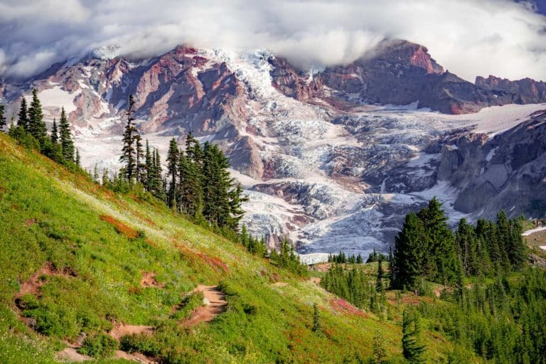
1. Apostle Islands National Lakeshore

This is the best NPS site in Wisconsin, and it is not close. If you only have time for one, come here.
Apostle Islands National Lakeshore protects 21 islands plus a 12-mile stretch of mainland shore on Lake Superior, off the Bayfield Peninsula in the far north of the state. The headline attraction is the sea caves, sandstone arches and chambers carved into the cliffs that you reach by kayak or tour boat in summer. In a cold enough winter the lake freezes solid and the caves turn to ice, and people walk out to them. That does not happen every year, so do not plan a trip around it. Check the park’s ice line before you drive north.
Beyond the caves, the islands hold more historic lighthouses than any other unit in the National Park System, several of them open for tours. There are more than 50 miles of hiking trails out on the islands, leading to old quarries, logging camps, beaches, and overlooks. Camping is allowed on 18 of the 21 islands at $15 a night per site, which means you need a boat or a guide to get out there. The lake is the whole point and also the whole challenge.

Getting on the water is the move. Bayfield is the hub, and outfitters there run guided kayak tours to the sea caves, motorized water taxis to drop you on an island for the day, and sailing charters around the chain. If you have never paddled big open water, take a guided trip. Lake Superior is cold and the weather turns fast.
2. Ice Age National Scenic Trail
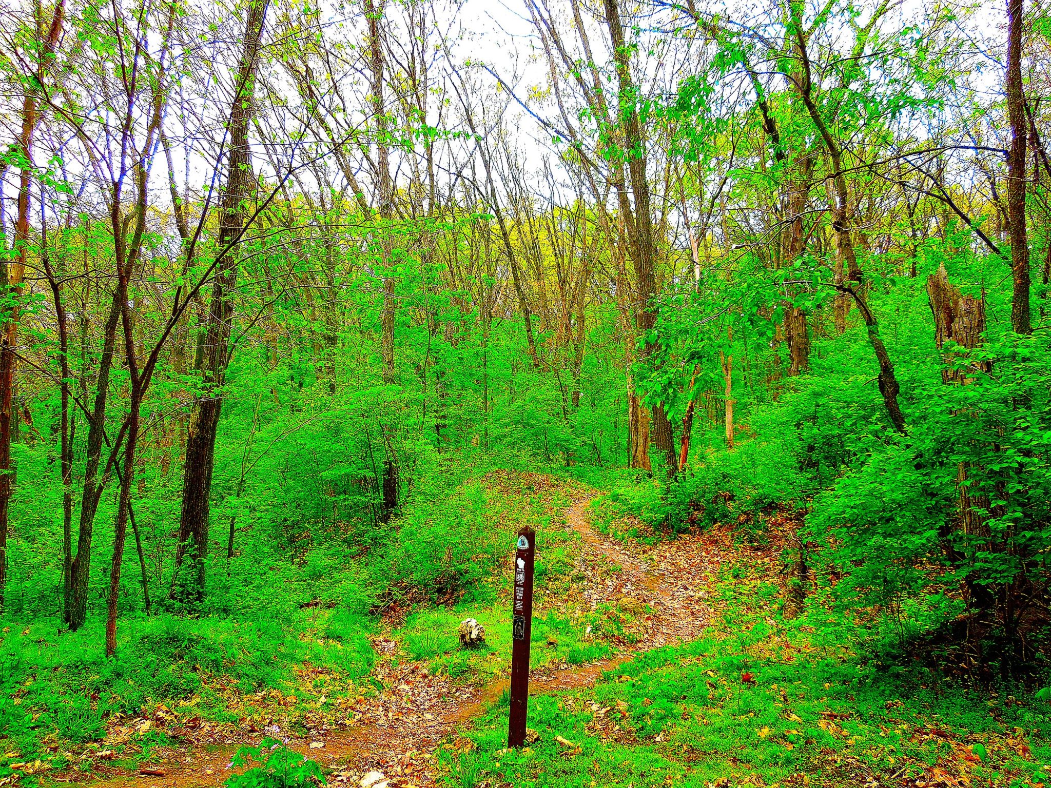
A roughly 1,200-mile trail that follows the last glacier’s terminal moraine, and the whole thing stays inside Wisconsin. That is rare. Most national scenic trails sprawl across many states. This one is the state’s own.
Here is the history, since it is my department. A Milwaukee lawyer and conservationist named Ray Zillmer pushed the idea starting in the 1950s. Congress made it a National Scenic Trail in 1980. The route traces the line where the Wisconsin glaciation stopped about 12,000 years ago, which is why you walk past kettles, eskers, and moraines, the leftover plumbing of an ice sheet a mile thick. If you ever taught earth science, this trail is a field trip you can hike.
You do not thru-hike this on a vacation. The Ice Age Trail is built for day hikes and weekend sections, and the National Park Service maintains it with a network of volunteer chapters. Pick a segment near where you already are. Devil’s Lake, the Kettle Moraine units, and the stretch around Cross Plains are popular and well marked. Camping is allowed only in designated spots and the gaps between them can be long, so plan multi-day sections carefully.
3. Saint Croix National Scenic Riverway

Two clear rivers, more than 200 miles of protected water, and a place in the original 1968 Wild and Scenic Rivers Act. This is the paddler’s pick on the list.
The riverway covers the St. Croix and its tributary the Namekagon, and it is shared with Minnesota along the lower river, which forms the border between the two states. When Congress passed the Wild and Scenic Rivers Act in 1968, the St. Croix was one of the first eight rivers named to it. Local citizens and the St. Croix River Association had spent years fighting development to make that happen, and it stuck. The water is clean enough to support bass, walleye, and musky, and bald eagles, beavers, and river otters work the banks.
Canoe and kayak the upper Namekagon for quiet, narrow water, or the broader St. Croix for an easier float. There are seven hiking trails open year-round on the Wisconsin side, including the three-mile Ridge View Trail with its basalt outcrops and the Sandrock Cliffs Trail, which closes on sandstone bluffs along a side channel. Ranger-led canoe trips and campfire programs run in season and are worth catching if you can line up the timing.
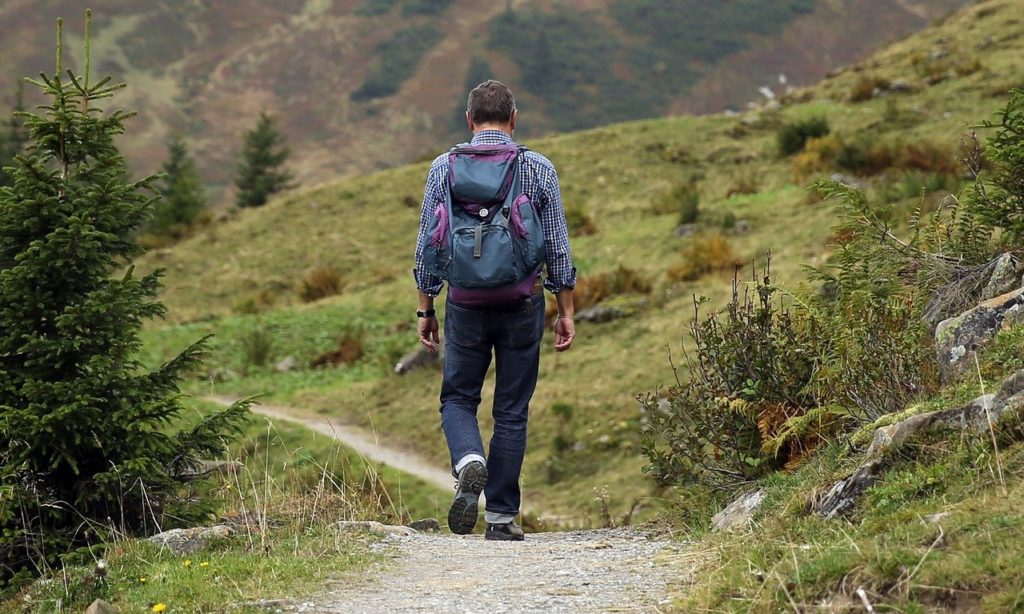
The Long-Distance Trail: North Country National Scenic Trail

Wisconsin’s fourth NPS unit is a piece of a much longer route. The North Country National Scenic Trail runs across eight states, from Vermont to North Dakota, and it clips the northwest corner of Wisconsin. It is worth knowing a couple of things about the Wisconsin stretch.
- The trail covers roughly 200 miles in Wisconsin, passing through Douglas, Bayfield, Ashland, and Iron counties.
- It enters from Minnesota’s Jay Cooke State Park and leaves by crossing the Montreal River into Michigan’s Upper Peninsula.
- Wisconsin gave the trail its name. A 60-mile route in the Chequamegon-Nicolet National Forest was the original inspiration for the whole idea of a multi-state northern trail.
- Like the Ice Age Trail, you hike it in sections. It is best treated as a way to access the Chequamegon-Nicolet backcountry rather than a destination in itself.
How to See Wisconsin’s Parks
Wisconsin’s NPS sites do not line up for one tidy loop, so do not try to force it. The geography splits in two. The Apostle Islands and the North Country Trail sit up in the far north on and near Lake Superior. The St. Croix runs down the western border, and the Ice Age Trail snakes through the southern and eastern part of the state. Pick a region and go deep instead of racing between them.
A good long weekend: base in Bayfield, take a guided kayak trip to the Apostle Islands sea caves, and hike a North Country Trail segment in the Chequamegon-Nicolet on your way in or out. Add a few days and drop down to paddle the Namekagon and walk a stretch of the Ice Age Trail near Devil’s Lake.
If you have one trip, make it the Apostle Islands in late summer when the lake is calm enough to reach the sea caves by kayak. That is the experience people remember, and nothing else in the state matches it.